Advanced Aerial Imaging and Geospatial Data
Achieving successful aerial data or imagery acquisition in Baton Rouge demands comprehensive expertise, far beyond simply deploying a helicopter. It necessitates intricate mission planning, seamless sensor integration, and meticulous navigation of regulatory approvals. Helicopters Over Baton Rouge serves as your dedicated aviation solutions partner, streamlining this complex process. We meticulously assess your precise data or footage requirements, identify the optimal aircraft for the mission profile, and expertly manage all flight planning, logistics, and permit acquisition. This integrated approach provides you with a single, trusted point of accountability, delivering a truly turnkey result for your critical projects.
Cinema & Broadcast Videography
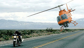
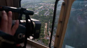
For the dynamic film and broadcast industry in Baton Rouge and across Louisiana, we specialize in delivering the stable, high-performance aerial platforms essential for breathtaking visuals. From feature films to live events, we provide aircraft perfectly suited for Directors of Photography, ensuring seamless integration with industry-standard stabilization systems such as Shotover, Cineflex, and Tyler Mounts. Our operational teams coordinate meticulously with your production crew, guaranteeing precise flight execution for every critical shot and capturing unparalleled aerial cinematography.
Aerial Photography
Elevate your brand with stunning high-resolution aerial imagery for marketing assets, comprehensive real estate portfolios, and precise progress documentation across Baton Rouge. We ensure the delivered visuals capture optimal lighting, compelling angles, and professional composition, providing magazine-quality stills that powerfully convey your message and enhance your projects' professional appeal.
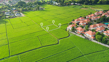
LiDAR & Geospatial Surveying
We provide advanced geospatial data solutions extending beyond visible light, crucial for informed decision-making across Louisiana. Our services include precision LiDAR acquisitions, detailed orthomosaic mapping, and robust 3D terrain modeling, supporting critical urban planning, utility infrastructure inspections, and essential environmental monitoring projects throughout the Baton Rouge area and beyond.
Utility & Asset Inspection
Achieve rapid, highly detailed inspections of vital infrastructure such as transmission lines, pipelines, and cell towers. Our helicopter services offer the stable hover capability and unparalleled flight precision essential for conducting high-fidelity asset auditing, ensuring thorough data collection across Baton Rouge and neighboring parishes.
Technical FAQ
Our aerial platforms are precisely configured to accommodate all major industry-standard camera mounts, including leading systems like Shotover (F1, K1), Cineflex, and Wescam. For projects utilizing lighter cinema payloads, we also readily support specialized options such as Tyler Minigyro and Middle mounts, ensuring broad compatibility for your production needs.
Absolutely. We manage all required airspace authorizations and meticulously plan flights necessary for complex urban operations in Baton Rouge. Our experienced personnel are proficient in navigating controlled airspace, ensuring every aerial shot is captured legally and safely, providing peace of mind for your project.
We offer a flexible, turnkey solution that can include a specialized sensor operator, or we can expertly fly your own creative team. Should you bring your crew, we will provide thorough briefings on essential safety protocols and efficient air-to-ground coordination procedures, ensuring a seamless and secure operation.
Depending on your specific sensor payload, we deliver diverse data outputs, including raw point clouds (LAS/LAZ), high-resolution orthomosaic maps (TIFF/ECW), or meticulously processed 3D meshes. We actively collaborate with your GIS team to guarantee seamless file compatibility and integration into your existing systems.
Gallery
Aerial Photography
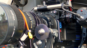
Camera Equipment
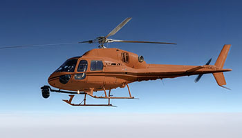
Camera Mounts
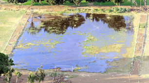
Damage Survey
Real Estate Survey
Aerial Videography
Complete Aerial Photography & Videography Solutions in Baton Rouge
Connect with Helicopters Over Baton Rouge at 1-855-445-8965 today for a swift and complimentary quote on superior helicopter aerial photography services right here in Baton Rouge.